Land Surveying &
Mapping
Leverage aerial drone technology for precise land surveying and high-resolution mapping with faster data capture.Enhance efficiency, improve safety, and reduce asset risk with accurate, reliable geospatial insights.
Land Surveying & Mapping Services in India
Topographic
Surveying
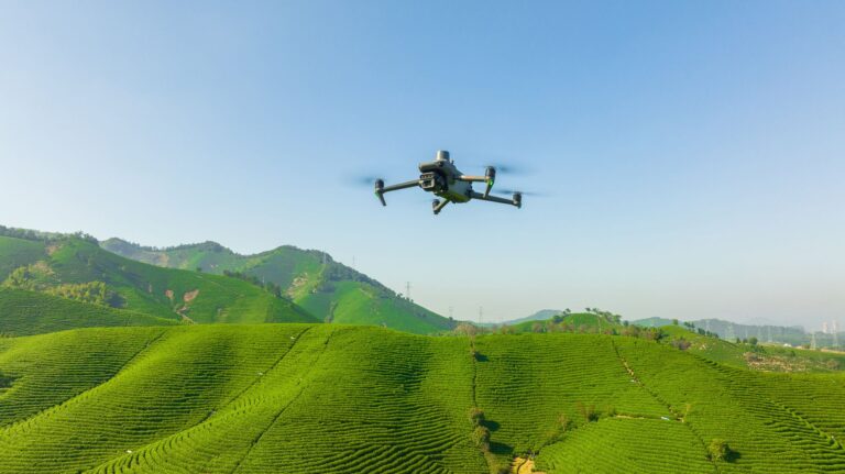
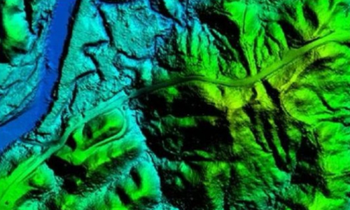
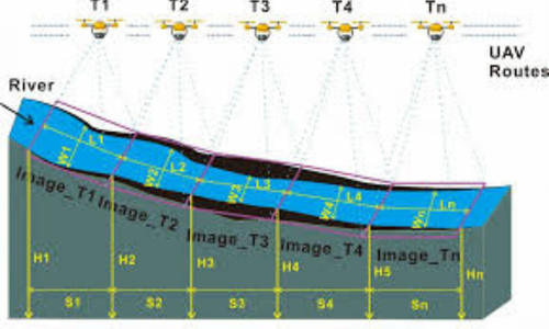
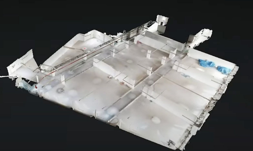
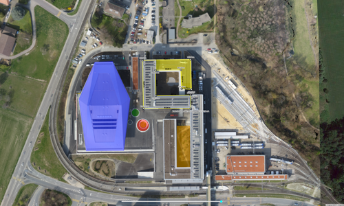
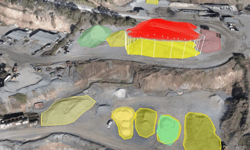
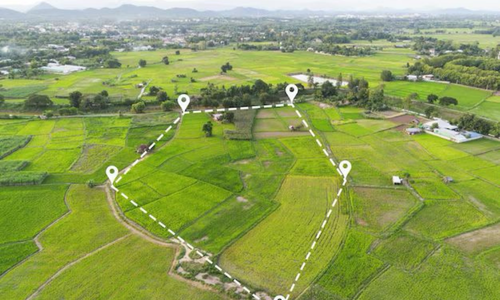
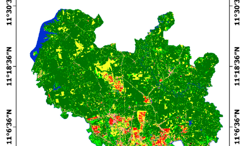
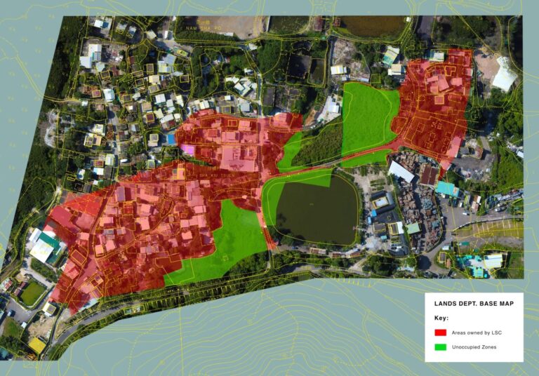
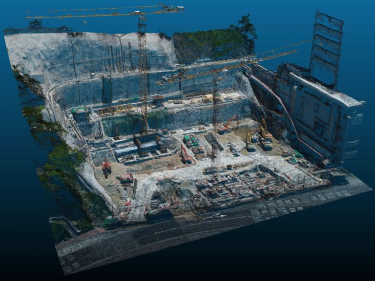
We deliver highly accurate topographic surveys using advanced drone technology to capture detailed information about natural and man-made features on the land. Our surveys include elevation data, slopes, contours, vegetation, and structures, helping engineers, architects, and planners make informed design and development decisions while reducing time, cost, and on-ground risks.
LiDAR
Drone Mapping
Using laser scanning technology, we can work in poor lighting and effectively penetrate through dense vegetation, creating data-rich surface maps with centimeter-level accuracy.
Hydrology
Surveys
Through advanced aerial surveying, we provide comprehensive data on drainage patterns, water flow, and flood zones for effective environmental assessments without delays.
3D Terrain & Surface Modeling
Our 3D terrain and surface modeling services provide realistic and highly detailed representations of land areas. Using drone imagery and advanced processing software, we generate accurate digital elevation models (DEMs) and surface models that support feasibility studies, design validation, and simulation for large-scale projects.
Orthomosaic
Mapping
We produce high-resolution, georeferenced orthomosaic maps that combine multiple aerial images into a single, distortion-free image. These maps offer precise spatial accuracy and are ideal for measurements, site analysis, asset mapping, and progress monitoring across various industries.
Volumetric
Analysis
Our drone-based volumetric analysis services enable accurate measurement of stockpiles, excavations, and earthworks. This data helps clients track material quantities, monitor site progress, reduce wastage, and improve cost control. Compared to traditional methods, drone surveys provide faster results with higher accuracy.
Route & Corridor Mapping
We offer drone-based route and corridor mapping for roads, pipelines, transmission lines, and railways. This service captures detailed data along linear infrastructure corridors, supporting planning, alignment optimization, and impact assessment while improving safety and reducing field survey challenges.
Land Use & Land Cover Mapping
Our land use and land cover mapping services analyze how land is utilized and classified across large areas. Using drone imagery, we help clients in urban planning, environmental impact assessment, agriculture planning, and land management by providing accurate and up-to-date spatial insights.
Progress & Change Detection Mapping
Through periodic drone surveys, we monitor land and site changes over time with high precision. This service helps detect encroachments, erosion, unauthorized activities, and development progress, enabling stakeholders to make timely, data-driven decisions with confidence.
Deliverables we provide
Post Processed Drone Video
Drone Videos help our clients to take a quick overview of their critical assets. Our highly professional editing team performs post-processing on Drone videos highlighting every possible important information of client’s assets. These highly informative drone videos help our clients in decision making about their critical assets, avoiding operation failure, avoiding accidents, improving safety, ensuring structural integrity, maximizing efficiency and production, etc.
Drone Image
Our drones are equipped with advanced sensors like Thermal sensor and RGB Image sensor and can deliver Images with 4k resolution. We help our clients by delivering aerial data (images) of inaccessible areas. This data provides our clients with a detailed view of their assets, enabling them to assess asset conditions under load. Additionally, our clients utilize aerial images to keep a track of their important assets.
Industries Benefiting from Land Surveying & Mapping
Real Estate
Infrastructure
Highways & Roads
Mining
Agriculture
Renewable Energy
Ready to Get Started?
Contact us today to discuss your project requirements
and discover how our drone solutions can benefit your business.